2. Micro Mapping Party Rapperswil 2011: Unterschied zwischen den Versionen
Aus Geoinformation HSR
Stefan (Diskussion | Beiträge) |
Stefan (Diskussion | Beiträge) |
||
| Zeile 1: | Zeile 1: | ||
'''2. Mapping Party Rapperswil und 20. OSM-Treffen Zürich u. Umgebung''' | '''2. Mapping Party Rapperswil und 20. OSM-Treffen Zürich u. Umgebung''' | ||
| − | [[File:2_Mapping_Party_Rappi_Marker.png|120px|frameless|right| | + | [[File:2_Mapping_Party_Rappi_Marker.png|120px|frameless|right|Click für Details...]] |
| − | [[File:2_Mapping_Party_Rappi_OSM_Overlay.png|190px|thumb|right|Click für Details... / Bild unten: Browse in OSM...]] | + | [[File:2_Mapping_Party_Rappi_OSM_Overlay.png|190px|thumb|right|Bild: Click für Details... / Bild unten: Browse in OSM...]] |
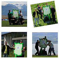
[[File:2_Mapping_Party_Rapperswil_klein.png|||right|link=http://www.openstreetmap.org/browse/way/34754486]] | [[File:2_Mapping_Party_Rapperswil_klein.png|||right|link=http://www.openstreetmap.org/browse/way/34754486]] | ||
Version vom 19. Juni 2011, 18:33 Uhr
2. Mapping Party Rapperswil und 20. OSM-Treffen Zürich u. Umgebung


Informationen und Anmeldung siehe OSM-Treffen Zürich (http://bit.ly/mmmiAO) auf dem OSM-Wiki.
Siehe auch: Micro_Mapping_Party_Rappi, OSM.