3. Micro Mapping Party Rapperswil 2014: Unterschied zwischen den Versionen
Stefan (Diskussion | Beiträge) K |
Stefan (Diskussion | Beiträge) K |
||
| Zeile 9: | Zeile 9: | ||
<gallery> | <gallery> | ||
| − | Datei:2014-05-23_20. | + | Datei:2014-05-23_20.06.15.jpg|The sign to the mapping event |
| − | Datei:2014-05-23_20.09.40.jpg| | + | Datei:2014-05-23_20.09.40.jpg|The crowd |
| − | Datei:2014-05-23_20. | + | Datei:2014-05-23_20.12.02.jpg|Ready for barbecue! |
| − | Datei:2014-05-23_20. | + | Datei:2014-05-23_20.40.22.jpg|The barbecue |
</gallery> | </gallery> | ||
Version vom 28. Mai 2014, 07:49 Uhr


23. May 2014, starting at 14:00h, Building 6 (entry hall/foyer 'Seegebäude', see OSM-Marker-Stele), HSR Hochschule für Technik Rapperswil .
(Mappers pls. fill in your name at [1] (23. Mai only; man spricht auch Deutsch)).
Inhaltsverzeichnis
Photos
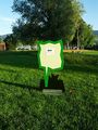
The sign to the mapping event
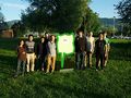
The crowd
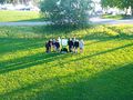
Ready for barbecue!
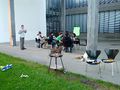
The barbecue


See the hidden secrets around the HSR campus: Wimmelkarte_des_HSR-Campus.
Organization
- What's the motto? "Mapping buildings and addresses in and around Rappi (and elsewhere)!"
- When does it start: 23. May 2014, 14:00h
- Where's the meeting point? Room/PC-Lab 6.004, Building 6, HSR Hochschule für Technik Rapperswil
- Who's the organizer? User:Stefan (Prof. Stefan Keller from Geometa Lab at IFS, HSR)
- Who participates? We expect a dozen people, mostly interns from Asia but also mappers from the surroundings.
- What to bring along? Your GPS and/or your mobile device with fully charged batteries (don't forget the power charger). Drink and food are offered by the HSR
Participant list:
- Stefan Keller (organizing team from Geometa Lab at IFS, HSR) together with
Rafael Krucker and
Tobias Schmitz - Team Violet - Phan Cong Minh (Minh) - Team Green
- Swarnima - Team Green
- Swoo Wei Cheng (Wei) - Team Green
- Chen Xianyao (Chen) - Team Red
- Liu Guanqun (Oliver) - Team Red
- Qi Zhang (Qi) - Team Red
- Hao Feng (Hao) - Team Blue
- Rolf Furrer, HSR - Team Blue
- Rolf Hotz, Mapper - Team Yellow
- Lukas Toggenburger - Mapper
- Marcel Amsler, HSR
- Daniel Kolb, HSR
- Wang Kailong
- Zhang Ruzhuang
Programm
Tentative(!) Program:
- 14:00 : Arrival at Building 6, HSR Campus Rapperswil
- 14:10 : Instructions
- 14:55 : Mapping outdoor
- 16:30 : Work on PC (Edit)
- 18:30 : Barbecue at "Fäschtinsle" nearby!
- ...until 20:20 sunset or open end.
FAQ
What is OpenStreetMap?
See OpenStreetMap (OSM) Wiki. The statistics showing the continuous growth of OSM are just stunning.
What's a Mapping Party?
See [2] (Was ist eine Mapping Party? siehe Micro Mapping Party Rapperswil).
How to Map an Address?
- To be a contributor to OpenStreetMap, firstly register to be an OSM user [3]
- Addresses can be tagged with addr:housenumber=* and the other addr:* keys. Tags can be added to
- isolated nodes
- nodes that are parts of building polygons ( = entrance=*s )
- building=* polygons
- on polygons representing the perimeter of the site.
- Buildings with multiple house numbers - There is currently no consensus on this but here are some possibilities:
- Create an address node for each housenumber and place each node somewhere on the building outline (or inside the building).
- Separate the numbers by commas (e.g., "11,13,15").
- Specify the range (e.g., "10-95"). This is the preferred method when such a range is officially used for the entire house. You may also use **addr:interpolation=* to describe whether that includes odd, even or all numbers.
How to Map a Building?
- A single building outline can be created for each building complex or 'block', which may relate to a single detached property, or to a row of individual terraced houses or to some more complex arrangement of properties. It is however better to create a series of linked outlines which share some nodes at the boundary to identify each distinct part of the property.
- Buildings can simply be building=yes
- If the building has an interior courtyard the use a Multipolygon relation to ensure that the courtyard is not rendered as part of the building.
- Please consider adding house numbers nodes to buildings with tags in addr:*=*-Namespace:
 entrance=yes (if you know where the entrance is)
 addr:street=*
 addr:housenumber=*
 addr:postcode=*
Why "Micro"...?
Micro has two meanings in this context: First, it's about a small party (usually it's about a weekend) - and second, it's about micromapping i.e. capturing of small scale features.