GEOSummit 2016: Unterschied zwischen den Versionen
Aus Geoinformation HSR
Stefan (Diskussion | Beiträge) K |
Stefan (Diskussion | Beiträge) K |
||
| Zeile 20: | Zeile 20: | ||
** angewandte Forschung & Entwicklung HSR | ** angewandte Forschung & Entwicklung HSR | ||
** [http://www.canon.ch/ Canon (Schweiz) AG] mit einem Grossformatplotter | ** [http://www.canon.ch/ Canon (Schweiz) AG] mit einem Grossformatplotter | ||
| − | ** | + | ** [http://www.sosm.ch Swiss OpenStreetMap Association] (SOSM) [http://wiki.openstreetmap.org/wiki/OSM_at_GEOSummit_2014 (Organisation)] |
== GEOSchool Day und MegaGEOGame == | == GEOSchool Day und MegaGEOGame == | ||
Version vom 25. Mai 2016, 17:59 Uhr
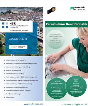
GEOSummit 2016, 7. bis 8. Juni 2016, BernExpo. HSR: Kompetenz in Geoinformation; in Zusammenarbeit mit UNIGIS, Canon und OpenStreetMap.
Inhaltsverzeichnis
Workshop "Vektor Tiles - Die Zukunft von WebGIS?"
- Am ersten Tag des GEOSummit, der alle 2 Jahre stattfindet, finden jeweils Workshops statt
- Di. 7. Juni 2016, 13:30-17:00 Uhr
- Mehr Informationen zum Workshop Vektor Tiles GEOSummit 2016
Workshop "Raumplanung..."
- Di. 7. Juni 2016, 9:00-12:00 Uhr
- Mehr Informationen: tbd.
Stand A05 in der Messe
- Mi. 7. und Do. 8. Juni 2016, jeweils 9-18 Uhr.
- Am Stand vertreten sind:
- HSR-Weiterbildung
- UNIGIS - Das GIS-Master Fernstudium
- HSR-Ausbildung Bachelor
- angewandte Forschung & Entwicklung HSR
- Canon (Schweiz) AG mit einem Grossformatplotter
- Swiss OpenStreetMap Association (SOSM) (Organisation)
GEOSchool Day und MegaGEOGame
- Mi. 7. und Do. 8. Juni 2016, 9:00-16:30, Treffpunkt GEOSchool Forum
- Während des ganzen Tages läuft das MegaGEOGame des Geometa Labs der HSR und von Esri (Schweiz).
- Mehr Informationen zum GEOSchool Day.
