HSR Texas Geo Database Benchmark: Unterschied zwischen den Versionen
Stefan (Diskussion | Beiträge) (→Introduction) |
Stefan (Diskussion | Beiträge) |
||
| Zeile 11: | Zeile 11: | ||
The benchmark is based on a predefined set of queries. These queries consist of simple spatial queries, defined in the OpenGIS(tm) 'Simple Features Interface Standard (SFS)'. The queries are performed on different-sized data sets for monitoring the behavior on various loads as well as on different hardware systems. | The benchmark is based on a predefined set of queries. These queries consist of simple spatial queries, defined in the OpenGIS(tm) 'Simple Features Interface Standard (SFS)'. The queries are performed on different-sized data sets for monitoring the behavior on various loads as well as on different hardware systems. | ||
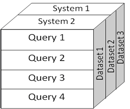
| − | [[Bild:HSR_Spatial_Benchmark_Fig1.png Draft of the benchmark.]] | + | [[Bild:HSR_Spatial_Benchmark_Fig1.png | Draft of the benchmark.]] |
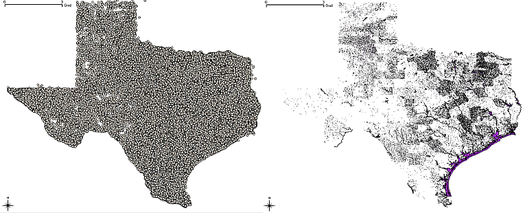
| − | [[Bild:HSR_Spatial_Benchmark_Fig2.png Visualization of the point (left) and polygon (right) data set.]] | + | [[Bild:HSR_Spatial_Benchmark_Fig2.png | Visualization of the point (left) and polygon (right) data set.]] |
== Methodology == | == Methodology == | ||
Version vom 21. Dezember 2009, 14:15 Uhr
The HSR Spatial Database Benchmark - A Proposal
Status: Call for Comments.
Introduction
This is a propoal for a spatial database benchmark from the University of Applied Sciences Rapperswil (HSR). A study of existing database benchmarks revealed that there exists no information publicly available which compares spatial database systems regarding their performance. Spatial databases typically form the persistence layer of a geographic information system (GIS).
Thus the Institute for Software at the University of Applied Sciences Rapperswil (HSR) decided to propose such a benchmark. This benchmark was called The HSR Spatial Database Benchmark. It was conducted and verified a first time on two database management systems software (DBMS), one commercially available an one under an Open Source license.
The benchmark is based on a predefined set of queries. These queries consist of simple spatial queries, defined in the OpenGIS(tm) 'Simple Features Interface Standard (SFS)'. The queries are performed on different-sized data sets for monitoring the behavior on various loads as well as on different hardware systems.
Methodology
The benchmark follows the below defined rules of engagement.
- Each test runs three times in a row, the results of the third run are used for the comparison: this benchmark assumes full system caches ('hot' benchmark).
- Each test takes place on the same machine.
- The other DBMS are shut down while the tests are running.
- The respective default installation of one DBMS is used.
- There is no tuning.
- Each DBMS has the same data.
- The spatial records used are spherical (geographical data) and come from real world data sets.
- Each test uses bounding box or point variables which are the same for the respective systems in the test. These variables are chosen at random from within the subset space.

