OSMaxx
"OSM Arbitrary Excerpt Export" (osmaxx) ![]()
The source of worldwide data for interactive and printed maps and for geospatial data analysis. Cuts out (extracts or excerpts) OpenStreetMap data, processes it to geodata and converts it to typical GIS fileformats before being prepared for download.
Die weltweite Geodatenquelle für interaktive und gedruckte Karten und für GIS Analyse. Schneidet OpenStreetMap-Daten aus (exract, excerpt), bereitet sie zu Geodaten auf und gibt sie als GIS-Fileformate ab.
Inhaltsverzeichnis
Weblinks
- Website: http://osmaxx.hsr.ch/
- Repository (Source Code, Ticketing): https://github.com/geometalab/osmaxx
- UI Mockup: http://geometalab.github.io/osmaxx/
- IFS internal (login required): https://wiki.ifs.hsr.ch/IfSwWiki/wiki.cgi?Osmaxx
Project
Project staff comes mainly from Geometa Lab HSR.
- Stefan: Lead and concept
- Raphael: Coordination, Integration, Frontend and Backend
- Tobias: Frontend (Javascript, ...)
- Nicola: Backend (Python, Postgres, ...)
- Eugene: PostGIS loading and schema transformation/data homogenization, (QGIS symbology)
- Lukas: Extraction tool chain (Linux tools, ...)
- Martin: ArcGIS symbology (ArcGIS)
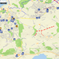
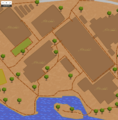
Map Gallery
This gallery shows some maps made with Osmaxx data using QGIS styling (see also [[Making Maps from OpenStreetMap Data):
Swiss Style (see also OpenEcoMap)
Vintage Map (see also Vintage Maps)
- Replace me.png
<<Replace me>>
- Replace me.png
<<Replace me>>


Description
German notes:
- Das Zielschema umfasst echte Geometrien (Punkt, Multi-Linestring, Multi-Polygon) und ein GIS-Datenmodell (Highways, Railways, Buildings, etc.).
- Zur Aufbereitung in das Zielschema gehört u.a. ein Postprocessing, dass die heterogenen OSM-Daten homogenisiert (z.B. Restaurants als Punktobjekte, auch wenn sie in OSM als Gebäudefläche erfasst wurden).
- Ein zusätzliches Zielschema enthält routingfähige Strassen. Dieses wird als Teil des Garmin-Formats abgebegen.
- Abgabeformate sind GIS-Fileformaten (GeoPackage, Shapefle, File Geodatabase) sowie ein Navi-Format (Garmin .IMG).
- Es werden auch Karten-Symbologien für QGIS und ArcGIS abgegeben, passend zu den GIS-Fileformaten.
Some explanations (incomplete):
- Selected OSM objects are transformed into Osmaxx tables (feature classes / layers). Some objects are captured in OSM as point, some as linestring or as area - and often both as point and area.
- All tables names contain a hint which geometry type they contain:
- poi_p => POIs with point geometry,
- roads_l => line/multilinestring,
- poi_a => area/multipolygon.
Documentation
End user oriented documents and files of Osmaxx project (download tbd.):
- "Internal"
- Data Model inc. Catalog of Objects/Entities (OSMaxx_Data_Model.odt) (=> see also https://github.com/geometalab/osmaxx-docs)
- Common fonts and symbols
- Font "Deja Vu"
- Point Symbols (.svg + .png)
Symbology "M1" (meaning optimized for scale 1:2.500, i.e.1:1.000 to 1:10.000)
- Symbol Catalog for "M1" (OSMaxx_SymbolCatalog.xlsx) (=> see also https://github.com/geometalab/osmaxx-docs)
- ArcGIS (.mdx/.lyr)
- QGIS (.qgs)
Symbology "M2" and "M3" (tbd.)
- ...
Data Model:
| Table Name | Description |
|---|---|
| address_a | Stores address information regarding a place or building. |
| adminarea_a | Administrative boundaries range from large groups of nation states right down to small administrative districts and suburbs, with an indication of this size/level of importance. |
| boundary_l | The boundary is used to mark the borders of areas, mostly political, but possibly also of other administrative areas. |
| building_a | To mark the outline of the area of the building. |
| geoname_l | The boarder of a settlement which is marked around the node and to mark the specific type of settlement. Eg. City, town, village, etc. |
| geoname_p | It is to mark the centre of a named settlement and the specific type of settlement. Eg. City, town, village, etc. |
| landuse_a | Landuse describes the human use of land, for example fields, pastures, and settlements. |
| military_a | See military_p. |
| military_p | The military is for buildings and land used by the military. |
| misc_l | This contains elements could not be categorized into specific tables. E.g barrier and cliffs. |
| natural_a | see natural_p. |
| natural_p | Used to describes natural physical land features, including small modification by humans. E.g glacier, volcano, mud, etc. |
| nonop_l | non-op./planned infrastructure not usable for traffic. |
| pow_a | See pow_p. |
| pow_p | This it a place of worship where people of different religion can go. e.g. church, temples(buddist, taoist, etc.), mosque(muslims) |
| poi_a | Points of interest features of a generic place, like shops, amenities, leisure, accomondation, pitches etc. |
| poi_p | Points of interest features of a generic place, like shops, amenities, leisure, accomondation, etc. |
| railway_l | All forms of transport using metal rails, including mainline services, subways, heritage lines and trams. |
| road_l | Any road, route, way, or thoroughfare on land which connects one location to another and has been paved or otherwise improved to allow travel by some conveyance, including motorised vehicles, cyclists, pedestrians, horse riders, and others |
| route_l | A route is a customary or regular line of passage or travel, often predetermined and publicized. Routes consist of paths taken repeatedly by people and vehicles. routes . |
| traffic_a | See traffic_p. |
| traffic_p | It contains information regarding the rules of the road. Which allow better flow of traffic. E.g. Road signs, traffic calming, etc. |
| transport_a | See transport_p. |
| transport_p | Features which mark out points or location where it enable transporting anyone from one place to another. E.g. Bus stops, train station, etc. |
| utility_a | See utility_l |
| utility_p | See utility_l |
| utility_l | All features which are part of the utility body. E.g. Power structure (powerlines, power building), pipelines (oil, water, gas etc.), etc.. |
| water_a | See water_l |
| water_p | See water_l |
| water_l | All features which are part of the waterbody. E.g. Dams, river, etc. |