QGIS Games: Unterschied zwischen den Versionen
Aus Geoinformation HSR
Stefan (Diskussion | Beiträge) K (→Quiz Plugin) |
Stefan (Diskussion | Beiträge) K (→Quiz Plugin) |
||
| (8 dazwischenliegende Versionen desselben Benutzers werden nicht angezeigt) | |||
| Zeile 2: | Zeile 2: | ||
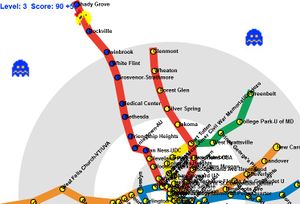
[[Datei:Metro_Distortion_Map.jpg|right|thumb|mini|Pac Man with Metro Distortion Map]] | [[Datei:Metro_Distortion_Map.jpg|right|thumb|mini|Pac Man with Metro Distortion Map]] | ||
| − | This is about a small project about the development of a game for | + | This is about a small project about the development of a game for QGIS (as Python plugin/PyQGIS). |
| + | |||
| + | See also: [[QGIS]] | ||
We're currently in incepton phase! Goal is a first release before June 2014! | We're currently in incepton phase! Goal is a first release before June 2014! | ||
| Zeile 20: | Zeile 22: | ||
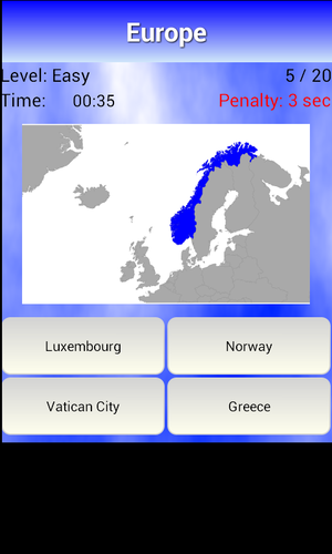
[[Datei:Geography_Quiz_Example.png|right|thumb|mini|Geography Quiz]] | [[Datei:Geography_Quiz_Example.png|right|thumb|mini|Geography Quiz]] | ||
| − | + | See [[QGIS Quiz Plugin]] and image to the right (taken from: [https://play.google.com/store/apps/details?id=com.hoffme.quiz.europegeo]) | |
| − | |||
| − | |||
| − | |||
| − | |||
| − | |||
| − | |||
| − | |||
| − | |||
| − | |||
| − | |||
| − | |||
| − | |||
| − | |||
| − | |||
| − | |||
| − | |||
| − | |||
| − | |||
| − | |||
| − | |||
| − | |||
| − | |||
| − | |||
| − | |||
| − | + | [[Kategorie:QGIS]] | |
| − | + | [[Kategorie:Software]] | |
| − | + | [[Kategorie:Game]] | |
Aktuelle Version vom 26. Februar 2014, 20:49 Uhr
This is about a small project about the development of a game for QGIS (as Python plugin/PyQGIS).
See also: QGIS
We're currently in incepton phase! Goal is a first release before June 2014!
Here are some initial ideas for brainstorming:
- Quiz
- Pac Man (Arcade style)
- on generated and self-edited labyrinth
- a la Metro Distortion Map [1]. (See figure to the right)
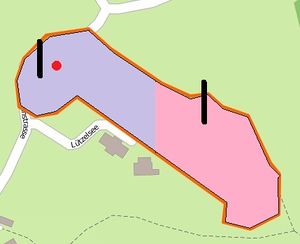
- OSM Pong (Arcade style, for two players on one keyboard): Playing inside an OpenStreetMap area; sidetracked ball (aka "coriolis effect") gives higher game level. (See figureto the right).
- Gold Digger
- A gamified enhancement of data capturing and editing, where one gets acoustic feedback and credit points for each added geographic (point, line or polygon) feature ("Serious game" style)
- Adapt a game from GBanga [2]
- Adapt a game from Bitforge [3]
Quiz Plugin
See QGIS Quiz Plugin and image to the right (taken from: [4])


